ashorean LandI’ve been in the air for hours. Finally, the turquoisetürkisfarbenturquoise Tasman Sea transforms into breakers crashing on to a long, golden coastline topped by farmland. Those little white spots? Some of the 26 million locals (sheep, that is). Coming into view is Auckland — New Zealand’s largest city, though not its capital — and beyond it lies the Pacific Ocean. The plane is landing on North Island, which sits over two colliding tectonic platetektonische Plattetectonic plates between two oceans, alone at the bottom of the world.
Known as the “City of Sails”, Auckland to hostveranstaltenhosted the America’s Cup yacht race in March 2021. With a population of 1.5 million, it has more boats per person than any other city in the world. Ferries sail frequently to many of the 50 islands in the Hauraki Gulf, taking in precious marine reserveMeeresschutzgebietmarine reserves along the way.
Island-hopping around Auckland
At the Edwardian ferry terminal building on Quay Street, I get on a ferry bound for ultra-chic Waiheke Island: a playground for wine lovers. Waiheke has around 30 wineries known for high-quality red wines. Visitors spend weekends going from one Waiheke cellar door to the next, with plenty of stylish accommodation, restaurants, galleries and idyllic beaches they can enjoy between wine tastings.
The next day, I go by ferry to one of the iconWahrzeichenicons of Auckland’s skyline: Rangitoto Island. The elegant shape of the island’s volcanic coneVulkankegelvolcanic cone can be seen from all over the city, and going ashore provides an opportunity to explore lava caveHöhlecaves and fields. There are 53 volcanic centres around the Auckland region, and Rangitoto was the site of its most recent volcanic eruption — around 600 years ago. From the top, I enjoy incredible views of the city and harbour.
Back in town, I relax at the waterside bar HeadQuarters, on the city’s Viaduct Basin — a yachtieSegler(in), Segel-Fanyachties’ paradise. Then I follow my nose uphill into the city. Auckland is home to people from more than 100 ethnicities — and they’ve brought their cuisines with them. I head upsich aufmachenhead up Queen Street, then over to Fort Street to sample some delicious international flavours.
To see Auckland from a different perspective, I stop off at the corner of Victoria and Federal Streets to visit the Sky Tower — New Zealand’s tallest building (328 metres to the top of the antenna mast). A high-speed elevatorLiftelevator takes me to panoramic scenes of the sunset over the city and harbour. daredevilDraufgänger(in)Daredevils can wear a full-body harnessGurtzeugharness, clip into safety lines and take a Sky Walk: a nerve-rackingnervenaufreibend, aufregendnerve-racking shuffleSchlurfgangshuffle around the outside of the tower. The very brave can take the to take the plungeden Sprung wagenplunge, literallyim wahrsten Sinne des Wortesliterally, with a Sky Jump: a base jumpObjektsprungbase jump by by wiream Stahlseilwire from 192 metres above street level.
Boiling geysers and giant redwoods
Having conquered the grand heights of Auckland, I hit State Highway 1 the next morning, going south towards the boil and bubbleBrodeln und Kochenboil and bubble of Middle EarthMittelerde, fiktiver Kontinent aus den Romanen von J. R. R. Tolkien Der Hobbit und Der Herr der RingeMiddle Earth. Two hours later, I’m in grassrootshier: ursprünglichgrassroots New Zealand. With 23 per cent of all the nation’s dairy cows found here, the Waikato region supplies dairy productMilchproduktdairy products from free-rangeaus Freilandhaltungfree-range, grass-fed animals to the rest of New Zealand and the world.
Info to go
Why are New Zealanders known as “Kiwis”? The kiwi is a small flightlessflugunfähigflightless bird found only in NZ. The Maori people hold the kiwi in high regard. New Zealanders began to be referred to as “Kiwis” in the early 20th century — and the nicknameSpitznamenickname has stuck ever since.
You’ve probably realized by now that we’re a farming nation — and you’d be forgiven for thinking that the sulphuricSchwefel-, schwefligsulphuric smell you noticed outside the city of Rotorua has something to do with farming. But no, this is in fact the odourGeruchodour of countless thermal steam ventDampfquellesteam vents, boiling mud poolSchlammbeckenmud pools and geyserGeysirgeysers in and around the city.
Rotorua, ironically nicknamedscherzhaft ... genanntnicknamed “Roto-Vegas” by locals (owing to its total absenceFehlenabsence of glitz and glamour), is located on a lake of the same name. It’s famous for its thermal activity. New Zealand’s indigenouseingeborenindigenous Maori settled here around 650 years ago, using natural thermal resources for cooking and washing and to treat ailmentKrankheitailments.
There are numerous ways to experience the region’s thermal wonders. I choose pure spectacle and head for Te Puia Springs to see the famous
Pohutu Geyser: the largest active geyser in the southern hemisphere. Pohutu eruptausbrechenerupts about 20 times a day for several minutes, giving visitors plenty of chances to to witnessbeobachten, miterlebenwitness it (which they can also do while driving through Rotorua on State Highway 30). Entry to Te Puia includes the opportunity to see young Maori artisanKunsthandwerker(in)artisans displaying their traditional carvingSchnitzkunstcarving, weavingWebereiweaving and tattooing skills at the New Zealand Maori Arts and Crafts Institute.
About an hour’s walk from Rotorua is the 5,600-hectare Whakarewarewa Forest, known as “The redwoodMammutbaumRedwoods” because of its majestic stand of Californian redwoods. Rather than walk at their feet, I decide to climb on to their shoulders and experience the Redwoods treewalkBaumwipfelpfadTreewalk. A network of bridges and platforms to suspendaufhängensuspended high above the forest floor, the Treewalk provides a wonderful opportunity to experience the forest in a new way. I walk up the spiral walkway after duskAbenddämmerungdusk, when clever light installations create a twinklingfunkelndtwinkling adventure playground, and spend a magical hour enjoying the enchantingbezauberndenchanting walk around the treetops.
Across the volcanic plateau
I continue south on State Highway 5, where thermal steam vents to mistin Nebel hüllenmist the countryside. I stop at Lake Taupo for lunch and take in the view across New Zealand’s largest lake. Lake Taupo fills the crater of the Taupo Volcano, one of the most active volcanoes in the world. This “supervolcano” is now considered dormant — but not extinct. New Zealanders have had to to adapt to sth.sich an etw. anpassenadapt to life “on shaky isles”: the country’s Institute of Geological and Nuclear Sciences measures more than 15,000 earthquakeErdbebenearthquakes every year — about 150 of them strong enough to be noticeable.
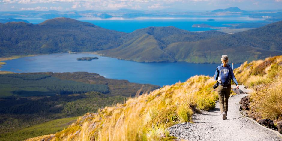
Travelling down the east side of Lake Taupo, the mountains of North Island’s Volcanic Plateau appear ahead: Ruapehu, Tongariro and Ngauruhoe (“Mount Doom” in the Lord of the Rings films). I drive to the foot of Mount Ruapehu and my next accommodation, the Chateau Tongariro Hotel. Sitting down to high teafrühes Abendessenhigh tea in the lush Ruapehu Lounge feels like a trip back in time. floor-to-ceilingraumhochFloor-to-ceiling windows offer views across to Tongariro and Ngauruhoe to peepspähen, lugenpeeping through the clouds.
Next morning, I to loop backzurückfahrenloop back up around the trio of mountains on to a section of State Highway 1 known as the Desert Road, crossing a barrenunwirtlichbarren yet beautiful alpine desert landscape. I drive carefully: this is one of New Zealand’s most dangerous stretchStrecke, Abschnittstretches of road — perhaps because we’re all so busy admiring the sceneryLandschaftscenery. Further south, at Taihape, I join the little-known “Gentle Annie Highway”, a pretty route that to descendherunterkommen,-führendescends from the North Island Volcanic Plateau to the Hawke’s Bay region.
Stepping back in time
native foresthier: unberührter WaldNative forest and high-country farms to give way to sth.etw. weichengive way to vineyards and orchardObstplantageorchards as I enter Hawke’s Bay. I arrive in the city of Napier, considered the art deco capital of the world. Destroyed by a massive earthquake (7.8 on the Richter scale) in 1931, which killed at least 256 people, the city was rebuilt in the art deco style of the time. Every February, locals commemorate the city’s rebirth with the Art Deco Festival, complete with vintage carOldtimervintage cars and aeroplane displayFlugschauaeroplane displays, train rides and Great Gatsby parties. I join a guided walking tour and take in the beautiful pastel-coloured
art deco architecture.
The Hawke’s Bay region is set on a fertilefruchtbarfertile plainEbeneplain that is perfect for producing fruit and wine. Between Napier and the neighbouring city of Hastings (also an art deco jewel) are countless orchards with roadside fruit stallVerkaufsstandstalls. I stop at one and pick up some fruit ice cream — a soft-serve blend you’ll find at most ruralländlichrural fruit shops.
Hawke’s Bay is New Zealand’s oldest wine-producing region, so I visit its oldest wineryWeingutwinery, the Mission Estate. Set inland on a low hill overlooking Napier, the Mission was established by pioneering French missionaries in 1851. I sample their exquisite Merlot and Cabernet Sauvignon wines, two blends for which the Hawke’s Bay region is best known.
I set off south across the rollingsanft hügeligrolling pastureWeidelandpastures of Central Hawke’s Bay, through the Wairarapa region to the foot of the Remutaka Range, over which a windy two-lane road leads to Wellington. I to cresterklimmencrest the summit and pause to enjoy the 360-degree view of dense native bushland covering the slopeHangslopes below.
The world’s coolest little capital
The harbour in Wellington laps up against high-rise offices, surrounded by 19th- and 20th-century villas clinging to windswept hillsides. The city forms a cul-de-sacSackgassecul-de-sac at the south end of North Island, to curlsich windencurled around the busy harbour as though to brace oneselfsich wappnenbracing itself against the cold wind.
From Oriental Bay to Queens Wharf, the waterfront is full of culture. I follow Writers Walk: Wellington-inspired prose to engraveerloschenengraved in concrete slabBetonplatteconcrete slabs half-hidden and awaiting discovery. “The wind is so strong that they have to fight their way through it, rocking like two old drunkardTrunkenbolddrunkards,” wrote Katherine Mansfield, Wellington’s most famous literary export.
But the star of the waterfront is the country’s national museum, called the Museum of New Zealand Te Papa Tongarewa. If there’s one museum that you should visit, this is it. The subjects of its permanent and temporary exhibitions range from the country’s eventful geological history to art from around the world to a full-scale Maori marae (meeting house).
Later, I make my way towards the Cuba Street district: the beating heart of New Zealand’s cafe culture. I take in the area’s hip boutiques and vintage stores and watch Cuba Street’s quirkyungewöhnlich, verrücktquirky Bucket Fountain — a brightly coloured fountainSpringbrunnenfountain made of tipping bucketEimerbuckets, known occasionally to splash passer-byPassantpassers-by.
From the city centre, I take the five-minute ride on the bright red Wellington cable carStandseilbahnCable Car, its bells clanging nostalgically. With only four stops, it doesn’t go far, but it does go up, helping commuterPendler(in)commuters to avoid the steepsteilsteep hike from the city to the suburbVorortsuburbs. After taking in the city views of Wellington and the harbour, I return to town through the historic Botanic Garden, native birdsong in my ears.
Our trip around New Zealand’s North Island ends here — but I’m continuing my journey, off to explore the untamedungezähmt, wilduntamed South Island, just a wild ferry ride away across the heavingwogendheaving swellWellengangswells of Cook Strait.
Neugierig auf mehr?
Dann nutzen Sie die Möglichkeit und stellen Sie sich Ihr optimales Abo ganz nach Ihren Wünschen zusammen.


